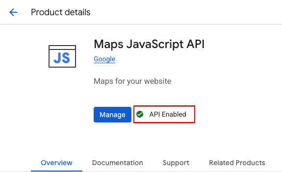
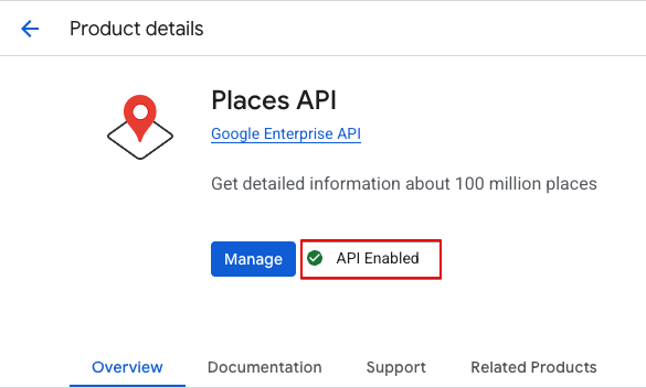
These APIs are essential for rendering maps, auto-completing addresses, and placing location markers.
OpenStreetMap via Leaflet (Free Option)
Pros: Free to use, no API key or billing required Cons: Slightly less detail in remote areas, no Street View
How to enable:
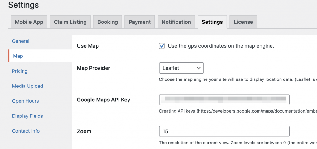
Navigate to: Dashboard → Settings → Map Options
Under Map Provider, select Leaflet.
No API key is needed.
Set your preferred Zoom, Latitude, and Longitude to define the map’s center.
Save changes.
Tip: Leaflet is lightweight and great for basic map functionality without recurring costs.
OpenStreetMap provider
Additional Settings
Use GPS Coordinates: Enable this to auto-locate listings on the map based on their coordinates.
Measure Distance Unit: Choose between kilometers (km) or miles (mi) for distance calculations between user and listing.
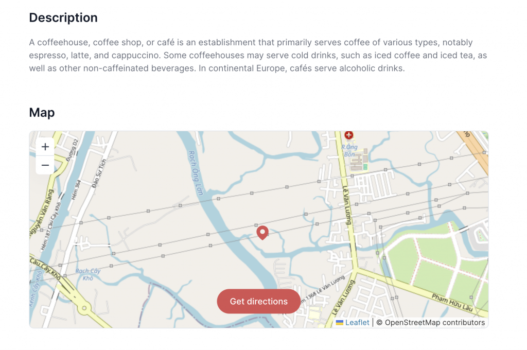
Display Location on Map
Show each listing’s exact location directly on an interactive map. This helps users visualize where the place is and how to get there. The map supports zooming, dragging, and clicking markers to view listing details.
Display location on map
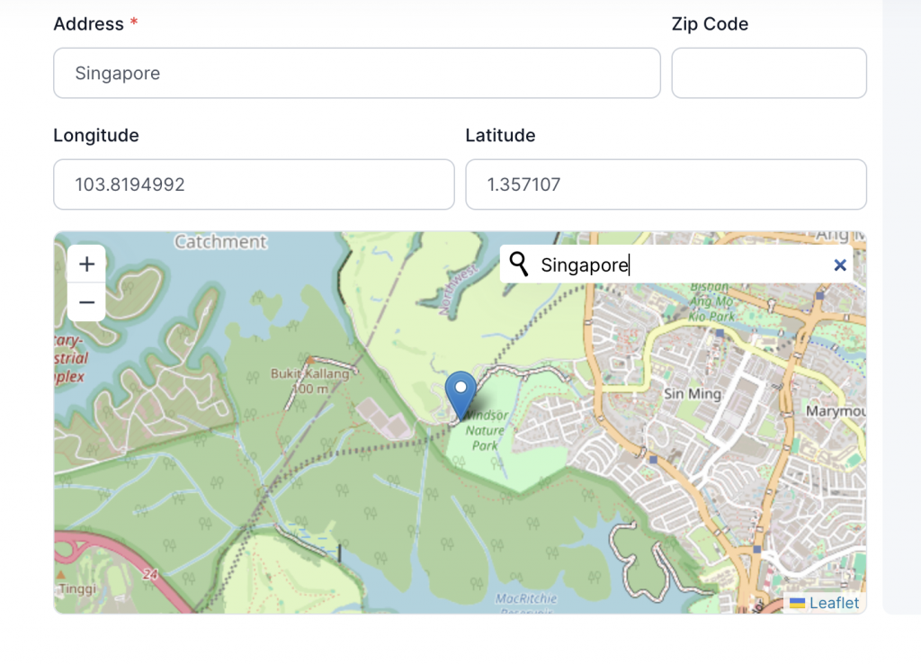
Search Address & Auto-Detect Coordinates
Easily search for an address and let the system automatically fetch the exact latitude and longitude. This saves time and ensures accurate map placement without manually entering GPS coordinates.
Searching the address & auto point location on map